Sunday, January 31, 2016
Minneapolis to Lake Pepin, MN
I made a series of maps for my trip down the river and never took the time to put them up on the blog. I have had some folks inquire about our trip so I thought I'd take the time to start posting them. I used Google maps and fashioned my own version of the Quimby's manual but with my personal preferences included. You see icons locating restaurants, bars, coffee shops, marinas etc. There is everything I thought I'd need to keep the river trip safe and comfortable. You might notice I even included libraries. and this is because I might need a place to wait out a rainy day.
Look for the rest of the map segments soon.
Tuesday, August 20, 2013
Captain's Log
Now that our trip is behind us it's time to reminisce and before it's too late I want to list some details that should be captured for the archives. Just one month ago we were in the middle of our adventure and already our efforts to recall it are becoming opaque as we've readjusted to workaday life. Sometimes Mary and I sit around and ask each other questions about something we saw, or where we were, or where we stayed, and all such variety of questions. It quickly became apparent that it's all running together in our heads and only the strongest memories are easily recalled. As a partial solution to this problem I've gathered up the notes we took along the way and I've used them, along with some other data, to compile a log that lists the vital details of each day. Jump ahead and take a look at Day #1 below as an example and you'll see our daily start and stop points along with the distances covered, the time we traveled, the dams we encountered, the places we stayed, what we ate, when we put on fuel, etc...
Time and Distance
The mileage for each of our stopping locations is indicated by the Corp of Engineers "Mile Marking System". This is listed next to each place with an entry like MM845 which stands for mile marker 845. These make a handy and accurate way to calculate distances and account for the winding nature of the river. If you know the mile markers for two different places then you can find the distance between them by simply subtracting the mile marker values. The daily and cumulative mile totals are listed as well as the time en route. I thought it would be interesting to know the elapsed time between our daily departure and arrival locations and I was able to capture this time by using a tracking app on my cell phone. It logged thousands of time stamps that tell me the exact time we were at a given location anywhere along our route. If I want to know when I was in a certain place I can just look it up by placing the time stamps onto Google maps or something equivalent. What I see in doing this is a"popcorn" trail of our route except with modern technology each piece of popcorn has written on it the time I was there.
Speed
Don't be confused by the relatively low entry for our Daily Average Speed. Believe me when I say the Blue Fin was cruising along at 20 mph most of the time. The daily average is simply the distance covered in a day divided by the time between departure and arrival. It captures all delays and stops for dams, food, fuel etc. It better conveys the general feel of the day's pace.
Fueling
When fueling I always filled up all of the containers we had and it usually took 6 to 12 gallons to fill them all. Fuel prices were generally in the range of $4.25 to $4.75 per gallon meaning a stop cost roughly $30-$60. The total trip fuel cost was about $750 as determined from our credit card receipts.
Lodging
Take note of the places we lodged and the star rating scale I put behind each entry. It's my,"made up" scale and it's relative only to this trip. Look also for the Y or N after the stars. This indicates either a Yes or No as to whether we'd stay at this place again. Don't be perplexed by a low star rating along with a Y. It means we were choosing for convenience of location rather than amenities. We tried as often as possible to stay close to the river allowing us to use our preferred mode of either walking or making use of our bicycles for ground transportation. Had we a car to get to places further into the river towns then you'd see fewer one and two star places.
After having actually executed this trip I'm convinced that anyone could replicate it with very little alteration. The distances covered, towns visited, services available, dams encountered etc can all be easily reenacted by anyone with a boat, a wallet full of money, and enough gumption. The biggest variable that might affect a reliving of the trip is perhaps the speed of the boat. Our actual running speed was usually 20 mph and in going significantly less than this it might not be possible to make it between the stopping points that we did. Moving faster, as on a jetski, might allow one to skip every other town, but remember the delays at dams can easily double the expected travel time between points. In some sense this makes a speedy jetski self defeating if the dam delays get too long.
I've been asked by many if I'd repeat a trip like this. My answer is a simple, "what for? Now it's your turn". To be honest there are parts I would and probably will repeat and others that I will not. The Mississippi River in the MN, WI, IA area is nice and, since it's close to our home, I'm sure we'll re-visit some places in the same manner as we did on this trip. I'd like to visit the Kentucky Lake and Tennessee River area again but to do it by boat would be difficult so perhaps by car or our motorhome is the best possibility. Immediately after our return home Mary said she had enough river boating to last a life time. Now with only a few weeks behind us, when asked, she agrees that maybe it would be fun to repeat some segments of the trip again. That's promising.
Before you drift down into the list below I'll summarize a few key highlights here:
The total distance we traveled: 1697 miles.
Total hours underway: 143h:05m
Overall trip average speed: 11.8 mph
Number of days we got rained on: 3
I don't have the exact figure but the rough cost of the trip was about $4800 or about $200 per day. This includes gas, food, and lodging. The Blue Fin cost about $6500 by the time it was all fixed up so an approximate grand total is $11,300. I had originally set my upper limit cost at around $15,000 so I'm pleased with this figure and it's satisfying to know the value of the boat is still intact and should be serviceable for quite a few years.
As proof of the Blue Fin's continued value it's already been to Lake Minnetonka and to the Apostle Islands in Lake Superior in the short time since it's return from the gulf. My children have been making good use of it and I'm glad to see every dollar of value wrung from it. And Matt explained to me that he was questioned at the boat launch on Lake Minnetonka as to where the boat was last in the water and where it will be going to next. The state of Minnesota puts staff at the popular boat launches to gather data for tracking the spread of Eurasian milfoil and zebra mussels and routinely asks boaters this question. I'm sure most often the answer is less spectacular than Matt's response of, "it was last in the gulf of Mexico and it will next be in Lake Superior". The Blue Fin is surely no slouch amongst boats.
OK, here's the list:
Day 1 - Thursday July 4, 2013
Depart: Watergate Marina in St Paul at 12:30PM , MM845
Arrive: Ole Miss Marina in Red Wing, MN at 5:50PM, MM791
Time en route 5h:20m
Cumulative Time en route 5h:20m
Distance: 54 miles, cumulative miles 54.
Daily average speed 7.5 mph
Lock and Dam: #3
Dinner: Walk to Red Wing Brewery, pizza and beer.
Lodging: Nichols Inn Motel. ***Y
Ground Transportation: Bicycle 1 mile.
Fuel: Filled up on land before launch
Weather: Sunny, warm.
Misc: Friends Joe and Terry tagged along in their boat.
Day 2 - Friday July 5, 2013
Depart: Ole Miss Marina Red Wing, MN 8:45 AM, MM791
Arrive: Riverfront Motel+Marina in Lacrosse, WI at 5:30PM, MM698
Time en route 7h:45m
Cumulative Time en route 13h:05m
Distance: 93 miles, cumulative 147 miles.
Daily average speed 10.5 mph
Lock and Dam: #4, #5, #5A, #6, and #7. The most in one day
Dinner: On site, River Jacks Restaurant, pork chop dinner.
Lodging: Best Western Riverfront Motel. **Y
Ground Transportation: Walk from courtesy dock at motel.
Fuel: #1 Fill up enroute at Lake City, MN Marina.
#2 Fill up enroute at Winona, MN Marina
Weather: Sunny, warm.
Misc: Entered Black River to access motel. Lost reserve gas tank off back of boat.
Day 3 - Saturday July 6, 2013
Depart: Riverfront Motel and Marina in Lacrosse, WI at 8:10AM, MM698
Arrive: Bill's Boat Landing in Clayton, IA at 3:45 PM, MM625
Time en route 7h:35m
Cumulative Time en route 20h:40m
Distance: 73 miles, cumulative 220 miles.
Daily average speed 8.7 mph.
Lock and Dam: #8, and #9.
Dinner: On site, Bill's Boat Landing, burgers and fries.
Lodging: Claytonian Inn. **Y
Ground Transportation: Walked 1 block to motel.
Fuel: Fill up enroute Brownsville, MN marina
Weather: Sunny, warm.
Misc: Passed through slough at Harpers Ferry.
Day 4 - Sunday July 7, 2013
Depart: Bill's Boat Landing in Clayton, IA at 9:10 AM, MM625
Arrive: Dubuque Yacht Basin in Dubuque, IA at 3:45 PM, MM581
Time en route 6h:35m
Cumulative Time en route 27h:40m
Distance: 44 miles, cumulative 264 miles
Daily average speed 5.6 mph
Lock and Dam: #10, and #11.
Dinner: On site, Caroline's Restaurant, pasta.
Lodging: The Julien Hotel. ****Y
Ground Transportation: Bicycle 2 miles.
Fuel: Fill up enroute Guttenberg, IA Marina
Weather: Sunny, warm.
Misc: Navigated the Potosi, WI channel to get beer. Visited family and relatives.
Day 5 - Mon July 8, 2013
Depart: Dubuque Yacht Basin in Dubuque, IA at 11:10 AM, MM581
Arrive: Savanna Marina in Savanna, IL at 3:40 PM, MM537
Time en route 4h:30m
Cumulative Time en route 32h:10m
Distance: 44 miles, cumulative 308 miles.
Daily average speed 10.9 mph
Lock and Dam: #12
Dinner: Bicycle to Manny's Pizza, pizza and salad.
Lodging: L+M Motel *Y
Ground Transportation: Bicycle 1.5 miles.
Fuel: Fill up at departure Dubuque, IA Ice Harbor Marina
Weather: Sunny, warm.
Misc: Entered mouth of the Galena River for fun.
Day 6 - Tuesday July 9, 2013
Depart: Savanna Marina in Savanna, IL at 9:20 AM, MM537
Arrive: Muscatine Public Marina in Muscatine, IA at 6:00 PM, MM455
Time en route 8h:40m
Cumulative Time en route 40h:50m
Distance: 82 miles, cumulative 390 miles.
Daily average speed 7.6 mph
Lock and Dam: #13, #14, #15, and #16.
Dinner: Walk to Applebee's, steak dinner.
Lodging: Super 8 Motel. *N
Ground Transportation: Bicycle 2.5 miles.
Fuel: #1 Fill up en route at Clinton, IA Marina
#2 Fill up en route at Le Claire, IA Marina
Weather: Windy rain AM, Sunny, warm PM.
Misc: Storm when behind L+D #13.
Day 7 - Wednesday July 10, 2013
Depart: Muscatine Public Marina in Muscatine, IA at 9:45 AM, MM455
Arrive: Captain Kirk's Marina in Ft Madison, IA at 3:15 PM, MM384
Time en route 5h:30m
Cumulative Time en route 46h:20m
Distance: 71 miles, cumulative 461 miles.
Daily average speed 10.7 mph
Lock and Dam: #17 and #18.
Dinner: Walk to Chuong Garden, moo shu pork and seafood delight.
Lodging: Kingsley Inn ***Y
Ground Transportation: Walk 4 blocks.
Fuel: Fill up enroute at Burlington, IA Marina
Weather: Sunny, warm.
Misc:
Day 8 - Thursday July 11, 2013
Depart: Captain Kirk's Marina in Ft Madison, IA at 9:20 AM, MM384
Arrive: Two Rivers Marina in Louisiana, MO at 5:50 PM, MM283
Time en route 8h:30m
Cumulative Time en route 54h:50m
Distance: 101 miles, cumulative 562 miles.
Daily average speed 9.8 mph
Lock and Dam: #19, #20, #21, and #22.
Dinner: Walk to Pikers Restaurant.
Lodging: Rivers Edge Motel *Y
Ground Transportation: car pickup by motel proprietor.
Fuel: #1 Fill up at Captain Kirk's before departure.
#2 Fill up en route at Quincy, IL
#3 Fill up at Two Rivers Marina at arrival.
Weather: Sunny, warm.
Misc: Marina and motel on opposite sides of river across long narrow bridge.
Day 9 - Friday July 12, 2013
Depart: Two Rivers Marina in Louisiana, MO at 8:50 AM, MM283
Arrive: Alton Marina in Alton, IL at 3:40 PM, MM203
Time en route 6h:50m
Cumulative Time en route 61h:40m
Distance: 80 miles, cumulative 642 miles.
Daily average speed 8.9 mph
Lock and Dam: #24, and #25.
Dinner: Walk to Princivali's Italian Cafe, Pasta Meatballs & Eggplant Parm.
Lodging: George St Inn **Y
Ground Transportation: Bicycle 2 miles.
Fuel: Fill up at Alton Marina Alton, IL at arrival.
Weather: Sunny, warm.
Misc: There is no L+D #23.
Day 10 - Saturday July 13, 2013
Depart: Alton Marina in Alton, IL at 10:40 AM, MM203
Arrive: Hoppies Marina in Imperial, MO at 4:30 PM, MM158
Time en route 5h:50m
Cumulative Time en route 67h:30m
Distance: 45 miles, cumulative 687 miles.
Daily average speed 6.5 mph
Lock and Dam: #26 Mel Price, #27 Chain of Rocks.
Dinner: Nick and Mary's house, various tasty food and good desert.
Lodging: Nick and Mary's house.
Ground Transportation: 10 miles by car.
Fuel: Fill up at Hoppies Marina at arrival.
Weather: Sunny, warm.
Misc: Passed downtown St Louis. Long wait at Mel Price L+D #26
Day 11 - Sunday July 14, 2013
Depart: N/A
Arrive: N/A
Distance: 0 miles, cumulative 687 miles.
Daily average speed 0 mph
Lock and Dam: N/A
Dinner: Nick and Mary's house, various.
Lodging: Nick and Mary's house.
Ground Transportation: N/A
Weather: Sunny, warm.
Misc: A day of non travel. Acquired 5 gallon portable gas can to carry along.
Day 12 - Mon July 15, 2013
Depart: Hoppies Marina in Imperial, MO at 7:45 AM, MM158
Arrive: Red Star Boat Ramp in Cape Girardeau, MO at 2:50 PM, MM53
Time en route 7h:05m
Cumulative Time en route 74h:35m
Distance: 105 miles, cumulative 792 miles.
Daily average speed 13.1 mph
Lock and Dam: None
Dinner: Walk to Outback Steakhouse, Cobb salad + spinach flat bread.
Lodging: Hampton Inn. ***Y
Ground Transportation: 4 miles by truck that was also towing the boat.
Fuel: Fill up at Cape Girardeau gas station while boat on trailer.
Weather: Sunny, warm.
Misc: Pulled from river using truck and trailer by Dustin of King Marine. Had engine oil changed.
Day 13 - Tuesday July 16, 2013
Depart: Red Star Boat Ramp in Cape Girardeau, MO at 8:50 AM, Miss MM53
Arrive: Green Turtle Bay Marina in Grand Rivers, TN at 7:50 PM
Mississippi MM 53 to MM0 then Ohio MM981 to MM923, and then Cumberland MM0 to MM47. Total = 158 miles.
Time en route 11h:00m (our longest day)
Cumulative Time en route 85h:00m
Distance: 158 miles, cumulative 950 miles.
Daily average speed 7.1 mph
Lock and Dam: Barkley Dam on Cumberland River.
Dinner: Walk to Patti's 1880's Settlement, shrimp skewers w/ asparagus
Lodging: Grand Rivers Inn. *Y
Ground Transportation: Bicycle 1.5 miles.
Fuel: Carried 5 gallon portable can to gas station in Paducah, KY
Weather: Sunny, warm.
Misc: Experienced first "water in fuel" problem.
Day 14 - Wednesday July 17, 2013
Depart: Green Turtle Bay Marina in Grand Rivers, TN at 11:00 AM, Tennessee River MM25
Arrive: Paris Landing State Resort Marina, TN at 2:45 PM, MM66
Time en route 3h:45m
Cumulative Time en route 88h:45m
Distance: 41 miles, cumulative 991 miles
Daily average speed 10.7 mph
Dinner: On site, Buffet at State Park Resort, chicken and fish
Lodging: Paris Landing State Park Resort Lodge. **Y
Ground Transportation: 1 mile courtesy ride on golf cart by park ranger.
Fuel: #1 Fill up at Green Turtle Bay upon departure.
#2 Fill up at Paris Landing marina upon arrival.
Weather: Sunny, warm. Storm after arrival at Paris Landing
Misc: Traversed Kentucky Lake in calm conditions.
Day 15 - Thursday July 18, 2013
Depart: Paris Landing State Resort Marina, TN at 9:00 AM, MM66
Arrive: Clifton Marina in Clifton, TN at 3:45 PM, MM 159
Time en route 6h:45m
Cumulative Time en route 95h:30m
Distance: 93 miles, cumulative 1084 miles
Daily average speed 11.7 mph
Lock and Dam: None
Dinner: On site, Bear Inn Restaurant, burgers and fries.
Lodging: The Bear Inn Resort. ***Y
Ground Transportation: 1.5 miles in car of Bear Inn Proprietor.
Fuel: Fill up at Clifton Marina upon arrival.
Weather: Sunny, warm. Isolated rain shower around noon.
Misc: Allison Boat rally on Tennessee River and at Bear Inn.
Day 16 - Friday July 19, 2013
Depart: Clifton Marina in Clifton, TN at 9:30 AM, MM159
Arrive: Pickwick Landing State Resort Marina, TN at 2:45 PM, MM207
Time en route 5h:15m
Cumulative Time en route 100h:45m
Distance: 48 miles, cumulative 1132 miles
Daily average speed 5.5 mph
Lock and Dam: Pickwick Dam
Dinner: On site, Buffet at State Park Resort, catfish
Lodging: Pickwick Landing State Park Resort Lodge. **Y
Ground Transportation: Bicycle 1 mile.
Fuel: Fill up at Pickwick Landing Marina upon arrival.
Weather: Sunny, warm. PM storm after arrival.
Misc:
Day 17 - Saturday July 20, 2013
Depart: Pickwick Landing State Resort Marina, TN at 8:00 AM, Tenn MM207 to MM215 then start Tenn-Tom Waterway MM450
Arrive: Midway Marina, Fulton, MS at 2:20 PM, Tenn-Tom Waterway MM394
Time en route 6h:20m
Cumulative Time en route 107h:05m
Distance: 63 miles, cumulative 1195 miles
Daily average speed 8.8 mph
Lock and Dam: #50 Jamie Whiten, #49 Sonny Montgomery, and #48 John Rankin.
Dinner: Bicycle to Homer's Restaurant, southern BBQ dinner
Lodging: Sands Motel. *N
Ground Transportation: Bicycle 2.5 miles.
Fuel: Fill up at Fulton Marina upon arrival.
Weather: Sunny, warm.
Misc: Lost boat key so back and forth to motel twice. Used hidden spare.
Day 18 - Sunday July 21, 2013
Depart: Fulton Marina, Fulton, MS at 9:30 AM, MM394
Arrive: Columbus Marina in Columbus, MS at 2:30 PM, MM334
Time en route 5h:00m
Cumulative Time en route 112h:05m
Distance: 60 miles, cumulative 1255 miles
Daily average speed 10.4 mph
Lock and Dam: #47 Fulton, #46 Glover Wilkins, and #45 Amory, #44 Aberdeen
Dinner: Walk to Logan's Restaurant, Meat loaf.
Lodging: Fairfield Inn. ***Y
Ground Transportation: By car 5 miles by wife of marina staff. Return in cab.
Fuel: Fill up at Columbus Marina upon arrival.
Weather: Sunny, warm.
Misc: Second episode of gas problems while at Aberdeen locks.
Day 19 - Monday July 22, 2013
Depart: Columbus Marina in Columbus, MS at 9:00 AM, MM334
Arrive: Demopolis Yacht Basin Marina, MS at 6:00 PM, MM217
Time en route 9h:00m
Cumulative Time en route 121h:05m
Distance: 117 miles, cumulative 1372 miles
Daily average speed 8.7 mph
Lock and Dam: #43 John Stennis, and #42 Tom Bevill
Dinner: On site, New Orleans Bar and Grill, crab cakes and mozzarella sticks
Lodging: Riverview Inn Motel *Y
Ground Transportation: Walk, motel onsite at marina.
Fuel: Fill up at Demopolis Yacht Basin upon arrival.
Weather: Sunny warm AM, Storm and lingering rain PM
Misc: Line of thunderstorms 50 miles to our north at time of departure. They caught up with us at Gainesville. Third episode of gas problems north of Gainesville. Finally got gas drier additive and solved problem once and for all.
Day 20 - Tuesday July 23, 2013
Depart: Demopolis Yacht Basin Marina, MS at 6:45 AM, MM217
Arrive: Bobbys Fish Camp, MS at 12:00 noon, MM119
Time en route 5h:15m
Cumulative Time en route 126h:20m
Distance: 98 miles, cumulative 1470 miles
Daily average speed 10.8 mph
Lock and Dam: #41 Howell Heflin.
Dinner: No available restaurant. Ate in room from canned food supplies we had with us, chicken noodle soup and Spam on crackers.
Lodging: Cottage at Bobbys Fish Camp *Y
Ground Transportation: Walk, cottage onsite at marina.
Fuel: Fill up at Bobbys upon arrival.
Weather: Sunny, warm. PM storm after arrival at Bobbys
Misc:
Day 21 - Wednesday July 24, 2013
Depart: Bobbys Fish Camp, MS at 6:30 AM, MM119
Arrive: Grand Mariner Marina, Dog River, Mobile, AL at 2:15 PM, MM0
Time en route 7h:45m
Cumulative Time en route 134h:05m
Distance: 119 miles, cumulative 1589 miles
Daily average speed 10.7 mph
Lock and Dam: Coffeville
Dinner: Walk to Godfather's, pizza
Lodging: Holiday Inn **Y
Ground Transportation: 5 miles in car of Troy who we met at marina. Return in motel courtesy van.
Fuel: Fill up at Grand Mariner Marina upon arrival.
Weather: Sunny, warm. Moderate to light chop in Mobile Bay
Misc: Had planned to stop at Fairhope on eastern shore but Mobile Bay too rough.
Day 22 - Thursday July 25, 2013
Depart: Grand Mariner Marina, AL at 7:50 AM
Arrive: Homeport Marina, Al at 10:00 AM
Time en route 2h:10m
Cumulative Time en route 136h:15m
Distance: 33 miles, cumulative 1622 miles
Daily average speed 15.3 mph
Lock and Dam: none
Dinner: Chineese food delivered to motel.
Lodging: Travel Lodge *N
Ground Transportation: 1 mile by bicycle.
Fuel: none
Weather: Sunny, warm. Moderate to light chop in Mobile Bay.
Misc: This segment was the crossing of Mobile Bay. We achieved the highest daily speed because no stops were made and the Blue Fin ran at approx 15 mph for the full 2h:10m of the crossing. The water was rough.
Day 23 - Friday July 26, 2013
Depart: Homeport Marina, AL at 10:30 AM
Arrive: Pensacola Beach Marina in Pensacola Beach, FL at 3:00 PM
Time en route 4h:30m
Cumulative Time en route 140h:45m
Distance: 37 miles, cumulative 1659 miles
Daily average speed 8.3 mph
Lock and Dam: none
Dinner: Walk to Shaggy's Restaurant, seafood
Lodging: Hampton Inn ****Y
Fuel: none
Weather: Sunny, warm.
Ground Transportation: Walking distance to motel.
Misc: Joined by Matt+Erin with a car and the Blue Fin's trailer.
Day 24 - Saturday July 27, 2013
Depart: Pensacola Beach Marina at 11:30 AM
Arrive: AJ's Restaurant Courtesy Dock in Destin, FL at 2:00 PM (our official end point)
Time en route 2h:30m
Cumulative Time en route 143h:05m
Distance: 38 miles, cumulative 1697 miles
Daily average speed 15.2 mph
Lock and Dam: none
Dinner: Boat to AJ's Restaurant, seafood
Lodging: Hampton Inn ****Y
Ground Transportation: Walking distance to motel.
Fuel: 4 gallons at Navarre, FL. Need to burn off fuel to lighten trailer load.
Weather: Sunny, warm AM, Overcast PM
Misc: Returned to Hampton Inn at Pensacola Beach at 5:30 PM
Day 25-26, Sunday and Monday, July 28 and 29, 2013.
Travel by car with boat in tow back to Minneapolis.
And one last thing. I can't help myself when it comes to stupid things like this so be patient. The propeller on the Blue Fin made the entire trip and came through without the slightest ding and the paint is only slightly worn off. I think this is beyond amazing and to celebrate I just have to know how many times it went around.
Here goes:
1697 miles X 5280 ft/mile = 8,960,160 feet
8,960,160 ft X 12 in/ft = 107,521,920 inches
The Blue Fin's propeller moves forward 19 inches for each revolution.
107,521,920 inches / 19 in/rev = 5,659,048 revolutions
Time and Distance
The mileage for each of our stopping locations is indicated by the Corp of Engineers "Mile Marking System". This is listed next to each place with an entry like MM845 which stands for mile marker 845. These make a handy and accurate way to calculate distances and account for the winding nature of the river. If you know the mile markers for two different places then you can find the distance between them by simply subtracting the mile marker values. The daily and cumulative mile totals are listed as well as the time en route. I thought it would be interesting to know the elapsed time between our daily departure and arrival locations and I was able to capture this time by using a tracking app on my cell phone. It logged thousands of time stamps that tell me the exact time we were at a given location anywhere along our route. If I want to know when I was in a certain place I can just look it up by placing the time stamps onto Google maps or something equivalent. What I see in doing this is a"popcorn" trail of our route except with modern technology each piece of popcorn has written on it the time I was there.
Speed
Don't be confused by the relatively low entry for our Daily Average Speed. Believe me when I say the Blue Fin was cruising along at 20 mph most of the time. The daily average is simply the distance covered in a day divided by the time between departure and arrival. It captures all delays and stops for dams, food, fuel etc. It better conveys the general feel of the day's pace.
Fueling
When fueling I always filled up all of the containers we had and it usually took 6 to 12 gallons to fill them all. Fuel prices were generally in the range of $4.25 to $4.75 per gallon meaning a stop cost roughly $30-$60. The total trip fuel cost was about $750 as determined from our credit card receipts.
Lodging
Take note of the places we lodged and the star rating scale I put behind each entry. It's my,"made up" scale and it's relative only to this trip. Look also for the Y or N after the stars. This indicates either a Yes or No as to whether we'd stay at this place again. Don't be perplexed by a low star rating along with a Y. It means we were choosing for convenience of location rather than amenities. We tried as often as possible to stay close to the river allowing us to use our preferred mode of either walking or making use of our bicycles for ground transportation. Had we a car to get to places further into the river towns then you'd see fewer one and two star places.
After having actually executed this trip I'm convinced that anyone could replicate it with very little alteration. The distances covered, towns visited, services available, dams encountered etc can all be easily reenacted by anyone with a boat, a wallet full of money, and enough gumption. The biggest variable that might affect a reliving of the trip is perhaps the speed of the boat. Our actual running speed was usually 20 mph and in going significantly less than this it might not be possible to make it between the stopping points that we did. Moving faster, as on a jetski, might allow one to skip every other town, but remember the delays at dams can easily double the expected travel time between points. In some sense this makes a speedy jetski self defeating if the dam delays get too long.
I've been asked by many if I'd repeat a trip like this. My answer is a simple, "what for? Now it's your turn". To be honest there are parts I would and probably will repeat and others that I will not. The Mississippi River in the MN, WI, IA area is nice and, since it's close to our home, I'm sure we'll re-visit some places in the same manner as we did on this trip. I'd like to visit the Kentucky Lake and Tennessee River area again but to do it by boat would be difficult so perhaps by car or our motorhome is the best possibility. Immediately after our return home Mary said she had enough river boating to last a life time. Now with only a few weeks behind us, when asked, she agrees that maybe it would be fun to repeat some segments of the trip again. That's promising.
Before you drift down into the list below I'll summarize a few key highlights here:
The total distance we traveled: 1697 miles.
Total hours underway: 143h:05m
Overall trip average speed: 11.8 mph
Number of days we got rained on: 3
I don't have the exact figure but the rough cost of the trip was about $4800 or about $200 per day. This includes gas, food, and lodging. The Blue Fin cost about $6500 by the time it was all fixed up so an approximate grand total is $11,300. I had originally set my upper limit cost at around $15,000 so I'm pleased with this figure and it's satisfying to know the value of the boat is still intact and should be serviceable for quite a few years.
As proof of the Blue Fin's continued value it's already been to Lake Minnetonka and to the Apostle Islands in Lake Superior in the short time since it's return from the gulf. My children have been making good use of it and I'm glad to see every dollar of value wrung from it. And Matt explained to me that he was questioned at the boat launch on Lake Minnetonka as to where the boat was last in the water and where it will be going to next. The state of Minnesota puts staff at the popular boat launches to gather data for tracking the spread of Eurasian milfoil and zebra mussels and routinely asks boaters this question. I'm sure most often the answer is less spectacular than Matt's response of, "it was last in the gulf of Mexico and it will next be in Lake Superior". The Blue Fin is surely no slouch amongst boats.
OK, here's the list:
Day 1 - Thursday July 4, 2013
Depart: Watergate Marina in St Paul at 12:30PM , MM845
Arrive: Ole Miss Marina in Red Wing, MN at 5:50PM, MM791
Time en route 5h:20m
Cumulative Time en route 5h:20m
Distance: 54 miles, cumulative miles 54.
Daily average speed 7.5 mph
Lock and Dam: #3
Dinner: Walk to Red Wing Brewery, pizza and beer.
Lodging: Nichols Inn Motel. ***Y
Ground Transportation: Bicycle 1 mile.
Fuel: Filled up on land before launch
Weather: Sunny, warm.
Misc: Friends Joe and Terry tagged along in their boat.
Day 2 - Friday July 5, 2013
Depart: Ole Miss Marina Red Wing, MN 8:45 AM, MM791
Arrive: Riverfront Motel+Marina in Lacrosse, WI at 5:30PM, MM698
Time en route 7h:45m
Cumulative Time en route 13h:05m
Distance: 93 miles, cumulative 147 miles.
Daily average speed 10.5 mph
Lock and Dam: #4, #5, #5A, #6, and #7. The most in one day
Dinner: On site, River Jacks Restaurant, pork chop dinner.
Lodging: Best Western Riverfront Motel. **Y
Ground Transportation: Walk from courtesy dock at motel.
Fuel: #1 Fill up enroute at Lake City, MN Marina.
#2 Fill up enroute at Winona, MN Marina
Weather: Sunny, warm.
Misc: Entered Black River to access motel. Lost reserve gas tank off back of boat.
Day 3 - Saturday July 6, 2013
Depart: Riverfront Motel and Marina in Lacrosse, WI at 8:10AM, MM698
Arrive: Bill's Boat Landing in Clayton, IA at 3:45 PM, MM625
Time en route 7h:35m
Cumulative Time en route 20h:40m
Distance: 73 miles, cumulative 220 miles.
Daily average speed 8.7 mph.
Lock and Dam: #8, and #9.
Dinner: On site, Bill's Boat Landing, burgers and fries.
Lodging: Claytonian Inn. **Y
Ground Transportation: Walked 1 block to motel.
Fuel: Fill up enroute Brownsville, MN marina
Weather: Sunny, warm.
Misc: Passed through slough at Harpers Ferry.
Day 4 - Sunday July 7, 2013
Depart: Bill's Boat Landing in Clayton, IA at 9:10 AM, MM625
Arrive: Dubuque Yacht Basin in Dubuque, IA at 3:45 PM, MM581
Time en route 6h:35m
Cumulative Time en route 27h:40m
Distance: 44 miles, cumulative 264 miles
Daily average speed 5.6 mph
Lock and Dam: #10, and #11.
Dinner: On site, Caroline's Restaurant, pasta.
Lodging: The Julien Hotel. ****Y
Ground Transportation: Bicycle 2 miles.
Fuel: Fill up enroute Guttenberg, IA Marina
Weather: Sunny, warm.
Misc: Navigated the Potosi, WI channel to get beer. Visited family and relatives.
Day 5 - Mon July 8, 2013
Depart: Dubuque Yacht Basin in Dubuque, IA at 11:10 AM, MM581
Arrive: Savanna Marina in Savanna, IL at 3:40 PM, MM537
Time en route 4h:30m
Cumulative Time en route 32h:10m
Distance: 44 miles, cumulative 308 miles.
Daily average speed 10.9 mph
Lock and Dam: #12
Dinner: Bicycle to Manny's Pizza, pizza and salad.
Lodging: L+M Motel *Y
Ground Transportation: Bicycle 1.5 miles.
Fuel: Fill up at departure Dubuque, IA Ice Harbor Marina
Weather: Sunny, warm.
Misc: Entered mouth of the Galena River for fun.
Day 6 - Tuesday July 9, 2013
Depart: Savanna Marina in Savanna, IL at 9:20 AM, MM537
Arrive: Muscatine Public Marina in Muscatine, IA at 6:00 PM, MM455
Time en route 8h:40m
Cumulative Time en route 40h:50m
Distance: 82 miles, cumulative 390 miles.
Daily average speed 7.6 mph
Lock and Dam: #13, #14, #15, and #16.
Dinner: Walk to Applebee's, steak dinner.
Lodging: Super 8 Motel. *N
Ground Transportation: Bicycle 2.5 miles.
Fuel: #1 Fill up en route at Clinton, IA Marina
#2 Fill up en route at Le Claire, IA Marina
Weather: Windy rain AM, Sunny, warm PM.
Misc: Storm when behind L+D #13.
Day 7 - Wednesday July 10, 2013
Depart: Muscatine Public Marina in Muscatine, IA at 9:45 AM, MM455
Arrive: Captain Kirk's Marina in Ft Madison, IA at 3:15 PM, MM384
Time en route 5h:30m
Cumulative Time en route 46h:20m
Distance: 71 miles, cumulative 461 miles.
Daily average speed 10.7 mph
Lock and Dam: #17 and #18.
Dinner: Walk to Chuong Garden, moo shu pork and seafood delight.
Lodging: Kingsley Inn ***Y
Ground Transportation: Walk 4 blocks.
Fuel: Fill up enroute at Burlington, IA Marina
Weather: Sunny, warm.
Misc:
Day 8 - Thursday July 11, 2013
Depart: Captain Kirk's Marina in Ft Madison, IA at 9:20 AM, MM384
Arrive: Two Rivers Marina in Louisiana, MO at 5:50 PM, MM283
Time en route 8h:30m
Cumulative Time en route 54h:50m
Distance: 101 miles, cumulative 562 miles.
Daily average speed 9.8 mph
Lock and Dam: #19, #20, #21, and #22.
Dinner: Walk to Pikers Restaurant.
Lodging: Rivers Edge Motel *Y
Ground Transportation: car pickup by motel proprietor.
Fuel: #1 Fill up at Captain Kirk's before departure.
#2 Fill up en route at Quincy, IL
#3 Fill up at Two Rivers Marina at arrival.
Weather: Sunny, warm.
Misc: Marina and motel on opposite sides of river across long narrow bridge.
Day 9 - Friday July 12, 2013
Depart: Two Rivers Marina in Louisiana, MO at 8:50 AM, MM283
Arrive: Alton Marina in Alton, IL at 3:40 PM, MM203
Time en route 6h:50m
Cumulative Time en route 61h:40m
Distance: 80 miles, cumulative 642 miles.
Daily average speed 8.9 mph
Lock and Dam: #24, and #25.
Dinner: Walk to Princivali's Italian Cafe, Pasta Meatballs & Eggplant Parm.
Lodging: George St Inn **Y
Ground Transportation: Bicycle 2 miles.
Fuel: Fill up at Alton Marina Alton, IL at arrival.
Weather: Sunny, warm.
Misc: There is no L+D #23.
Day 10 - Saturday July 13, 2013
Depart: Alton Marina in Alton, IL at 10:40 AM, MM203
Arrive: Hoppies Marina in Imperial, MO at 4:30 PM, MM158
Time en route 5h:50m
Cumulative Time en route 67h:30m
Distance: 45 miles, cumulative 687 miles.
Daily average speed 6.5 mph
Lock and Dam: #26 Mel Price, #27 Chain of Rocks.
Dinner: Nick and Mary's house, various tasty food and good desert.
Lodging: Nick and Mary's house.
Ground Transportation: 10 miles by car.
Fuel: Fill up at Hoppies Marina at arrival.
Weather: Sunny, warm.
Misc: Passed downtown St Louis. Long wait at Mel Price L+D #26
Day 11 - Sunday July 14, 2013
Depart: N/A
Arrive: N/A
Distance: 0 miles, cumulative 687 miles.
Daily average speed 0 mph
Lock and Dam: N/A
Dinner: Nick and Mary's house, various.
Lodging: Nick and Mary's house.
Ground Transportation: N/A
Weather: Sunny, warm.
Misc: A day of non travel. Acquired 5 gallon portable gas can to carry along.
Day 12 - Mon July 15, 2013
Depart: Hoppies Marina in Imperial, MO at 7:45 AM, MM158
Arrive: Red Star Boat Ramp in Cape Girardeau, MO at 2:50 PM, MM53
Time en route 7h:05m
Cumulative Time en route 74h:35m
Distance: 105 miles, cumulative 792 miles.
Daily average speed 13.1 mph
Lock and Dam: None
Dinner: Walk to Outback Steakhouse, Cobb salad + spinach flat bread.
Lodging: Hampton Inn. ***Y
Ground Transportation: 4 miles by truck that was also towing the boat.
Fuel: Fill up at Cape Girardeau gas station while boat on trailer.
Weather: Sunny, warm.
Misc: Pulled from river using truck and trailer by Dustin of King Marine. Had engine oil changed.
Depart: Red Star Boat Ramp in Cape Girardeau, MO at 8:50 AM, Miss MM53
Arrive: Green Turtle Bay Marina in Grand Rivers, TN at 7:50 PM
Mississippi MM 53 to MM0 then Ohio MM981 to MM923, and then Cumberland MM0 to MM47. Total = 158 miles.
Time en route 11h:00m (our longest day)
Cumulative Time en route 85h:00m
Distance: 158 miles, cumulative 950 miles.
Daily average speed 7.1 mph
Lock and Dam: Barkley Dam on Cumberland River.
Dinner: Walk to Patti's 1880's Settlement, shrimp skewers w/ asparagus
Lodging: Grand Rivers Inn. *Y
Ground Transportation: Bicycle 1.5 miles.
Fuel: Carried 5 gallon portable can to gas station in Paducah, KY
Weather: Sunny, warm.
Misc: Experienced first "water in fuel" problem.
Day 14 - Wednesday July 17, 2013
Depart: Green Turtle Bay Marina in Grand Rivers, TN at 11:00 AM, Tennessee River MM25
Arrive: Paris Landing State Resort Marina, TN at 2:45 PM, MM66
Time en route 3h:45m
Cumulative Time en route 88h:45m
Distance: 41 miles, cumulative 991 miles
Daily average speed 10.7 mph
Dinner: On site, Buffet at State Park Resort, chicken and fish
Lodging: Paris Landing State Park Resort Lodge. **Y
Ground Transportation: 1 mile courtesy ride on golf cart by park ranger.
Fuel: #1 Fill up at Green Turtle Bay upon departure.
#2 Fill up at Paris Landing marina upon arrival.
Weather: Sunny, warm. Storm after arrival at Paris Landing
Misc: Traversed Kentucky Lake in calm conditions.
Day 15 - Thursday July 18, 2013
Depart: Paris Landing State Resort Marina, TN at 9:00 AM, MM66
Arrive: Clifton Marina in Clifton, TN at 3:45 PM, MM 159
Time en route 6h:45m
Cumulative Time en route 95h:30m
Distance: 93 miles, cumulative 1084 miles
Daily average speed 11.7 mph
Lock and Dam: None
Dinner: On site, Bear Inn Restaurant, burgers and fries.
Lodging: The Bear Inn Resort. ***Y
Ground Transportation: 1.5 miles in car of Bear Inn Proprietor.
Fuel: Fill up at Clifton Marina upon arrival.
Weather: Sunny, warm. Isolated rain shower around noon.
Misc: Allison Boat rally on Tennessee River and at Bear Inn.
Day 16 - Friday July 19, 2013
Depart: Clifton Marina in Clifton, TN at 9:30 AM, MM159
Arrive: Pickwick Landing State Resort Marina, TN at 2:45 PM, MM207
Time en route 5h:15m
Cumulative Time en route 100h:45m
Distance: 48 miles, cumulative 1132 miles
Daily average speed 5.5 mph
Lock and Dam: Pickwick Dam
Dinner: On site, Buffet at State Park Resort, catfish
Lodging: Pickwick Landing State Park Resort Lodge. **Y
Ground Transportation: Bicycle 1 mile.
Fuel: Fill up at Pickwick Landing Marina upon arrival.
Weather: Sunny, warm. PM storm after arrival.
Misc:
Depart: Pickwick Landing State Resort Marina, TN at 8:00 AM, Tenn MM207 to MM215 then start Tenn-Tom Waterway MM450
Arrive: Midway Marina, Fulton, MS at 2:20 PM, Tenn-Tom Waterway MM394
Time en route 6h:20m
Cumulative Time en route 107h:05m
Distance: 63 miles, cumulative 1195 miles
Daily average speed 8.8 mph
Lock and Dam: #50 Jamie Whiten, #49 Sonny Montgomery, and #48 John Rankin.
Dinner: Bicycle to Homer's Restaurant, southern BBQ dinner
Lodging: Sands Motel. *N
Ground Transportation: Bicycle 2.5 miles.
Fuel: Fill up at Fulton Marina upon arrival.
Weather: Sunny, warm.
Misc: Lost boat key so back and forth to motel twice. Used hidden spare.
Day 18 - Sunday July 21, 2013
Depart: Fulton Marina, Fulton, MS at 9:30 AM, MM394
Arrive: Columbus Marina in Columbus, MS at 2:30 PM, MM334
Time en route 5h:00m
Cumulative Time en route 112h:05m
Distance: 60 miles, cumulative 1255 miles
Daily average speed 10.4 mph
Lock and Dam: #47 Fulton, #46 Glover Wilkins, and #45 Amory, #44 Aberdeen
Dinner: Walk to Logan's Restaurant, Meat loaf.
Lodging: Fairfield Inn. ***Y
Ground Transportation: By car 5 miles by wife of marina staff. Return in cab.
Fuel: Fill up at Columbus Marina upon arrival.
Weather: Sunny, warm.
Misc: Second episode of gas problems while at Aberdeen locks.
Day 19 - Monday July 22, 2013
Depart: Columbus Marina in Columbus, MS at 9:00 AM, MM334
Arrive: Demopolis Yacht Basin Marina, MS at 6:00 PM, MM217
Time en route 9h:00m
Cumulative Time en route 121h:05m
Distance: 117 miles, cumulative 1372 miles
Daily average speed 8.7 mph
Lock and Dam: #43 John Stennis, and #42 Tom Bevill
Dinner: On site, New Orleans Bar and Grill, crab cakes and mozzarella sticks
Lodging: Riverview Inn Motel *Y
Ground Transportation: Walk, motel onsite at marina.
Fuel: Fill up at Demopolis Yacht Basin upon arrival.
Weather: Sunny warm AM, Storm and lingering rain PM
Misc: Line of thunderstorms 50 miles to our north at time of departure. They caught up with us at Gainesville. Third episode of gas problems north of Gainesville. Finally got gas drier additive and solved problem once and for all.
Day 20 - Tuesday July 23, 2013
Depart: Demopolis Yacht Basin Marina, MS at 6:45 AM, MM217
Arrive: Bobbys Fish Camp, MS at 12:00 noon, MM119
Time en route 5h:15m
Cumulative Time en route 126h:20m
Distance: 98 miles, cumulative 1470 miles
Daily average speed 10.8 mph
Lock and Dam: #41 Howell Heflin.
Dinner: No available restaurant. Ate in room from canned food supplies we had with us, chicken noodle soup and Spam on crackers.
Lodging: Cottage at Bobbys Fish Camp *Y
Ground Transportation: Walk, cottage onsite at marina.
Fuel: Fill up at Bobbys upon arrival.
Weather: Sunny, warm. PM storm after arrival at Bobbys
Misc:
Day 21 - Wednesday July 24, 2013
Depart: Bobbys Fish Camp, MS at 6:30 AM, MM119
Arrive: Grand Mariner Marina, Dog River, Mobile, AL at 2:15 PM, MM0
Time en route 7h:45m
Cumulative Time en route 134h:05m
Distance: 119 miles, cumulative 1589 miles
Daily average speed 10.7 mph
Lock and Dam: Coffeville
Dinner: Walk to Godfather's, pizza
Lodging: Holiday Inn **Y
Ground Transportation: 5 miles in car of Troy who we met at marina. Return in motel courtesy van.
Fuel: Fill up at Grand Mariner Marina upon arrival.
Weather: Sunny, warm. Moderate to light chop in Mobile Bay
Misc: Had planned to stop at Fairhope on eastern shore but Mobile Bay too rough.
Day 22 - Thursday July 25, 2013
Depart: Grand Mariner Marina, AL at 7:50 AM
Arrive: Homeport Marina, Al at 10:00 AM
Time en route 2h:10m
Cumulative Time en route 136h:15m
Distance: 33 miles, cumulative 1622 miles
Daily average speed 15.3 mph
Lock and Dam: none
Dinner: Chineese food delivered to motel.
Lodging: Travel Lodge *N
Ground Transportation: 1 mile by bicycle.
Fuel: none
Weather: Sunny, warm. Moderate to light chop in Mobile Bay.
Misc: This segment was the crossing of Mobile Bay. We achieved the highest daily speed because no stops were made and the Blue Fin ran at approx 15 mph for the full 2h:10m of the crossing. The water was rough.
Day 23 - Friday July 26, 2013
Depart: Homeport Marina, AL at 10:30 AM
Arrive: Pensacola Beach Marina in Pensacola Beach, FL at 3:00 PM
Time en route 4h:30m
Cumulative Time en route 140h:45m
Distance: 37 miles, cumulative 1659 miles
Daily average speed 8.3 mph
Lock and Dam: none
Dinner: Walk to Shaggy's Restaurant, seafood
Lodging: Hampton Inn ****Y
Fuel: none
Weather: Sunny, warm.
Ground Transportation: Walking distance to motel.
Misc: Joined by Matt+Erin with a car and the Blue Fin's trailer.
Day 24 - Saturday July 27, 2013
Depart: Pensacola Beach Marina at 11:30 AM
Arrive: AJ's Restaurant Courtesy Dock in Destin, FL at 2:00 PM (our official end point)
Time en route 2h:30m
Cumulative Time en route 143h:05m
Distance: 38 miles, cumulative 1697 miles
Daily average speed 15.2 mph
Lock and Dam: none
Dinner: Boat to AJ's Restaurant, seafood
Lodging: Hampton Inn ****Y
Ground Transportation: Walking distance to motel.
Fuel: 4 gallons at Navarre, FL. Need to burn off fuel to lighten trailer load.
Weather: Sunny, warm AM, Overcast PM
Misc: Returned to Hampton Inn at Pensacola Beach at 5:30 PM
Day 25-26, Sunday and Monday, July 28 and 29, 2013.
Travel by car with boat in tow back to Minneapolis.
And one last thing. I can't help myself when it comes to stupid things like this so be patient. The propeller on the Blue Fin made the entire trip and came through without the slightest ding and the paint is only slightly worn off. I think this is beyond amazing and to celebrate I just have to know how many times it went around.
Here goes:
1697 miles X 5280 ft/mile = 8,960,160 feet
8,960,160 ft X 12 in/ft = 107,521,920 inches
The Blue Fin's propeller moves forward 19 inches for each revolution.
107,521,920 inches / 19 in/rev = 5,659,048 revolutions
The Blue Fin's propeller rotated over
5 million times to get us 2-2 The Gulf.
Wednesday, July 31, 2013
Back Home
Sorry we disappeared on you. We're now back home and getting resettled to normal life. We drove from the gulf up through Memphis, St Louis, Iowa, into MN and arrived home on Monday evening. The Blue Fin has been washed down to remove the remnants of salt water and the motor was flushed out too. I've been told the salt is really bad for the motor and will also eat the thin aluminum skin of the boat. Tomorrow we'll deliver it to Matt's house where it'll find a home and assume a new life as a boat for ordinary outings hopefully long into the future. When I first purchased the Blue Fin 13 months ago the thought was to use it for this trip and then sell it. Because it worked so well and was a pleasure to drive we decided to keep it to kick around Minnesota and places nearby.
I plan to put up a few more posts before I end this adventure to make sure I cover some details that might be useful for anyone else planning a trip such as our's. I want to list out a daily log of our start and stop locations along with the accommodations we found. Included will be food, marinas, motels and such things as that and I'll try to put up maps of the "points of interest" I had compiled in preparation for the trip. During the pre-trip research phase the info I found on other's websites was invaluable so this effort will be my way of giving back. Maybe it will provide someone else with the knowledge needed to execute a similar adventure. I plan to leave the blog up forever, or at least forever from my perspective. If Google goes bankrupt then maybe that'll be the end but I don't plan to take it down anytime soon and I'd bet Google doesn't go broke. I've already discovered that it makes a nice walk down memory lane for Mary and me.
The "MAP US" tab that shows our location has now been disabled so you'll no longer be able to track us. You didn't want to watch me going to work everyday anyway, did you?
Look for a few more post over the next weeks and thank you for tracking along with us. It caused us a feeling of comfort having you with us as we traveled.
 |
| Washed, polished and ready to move, the Blue Fin will find it's permanent home at Matt's house. We plan to do some additional work on the trailer to upgrade the fenders and add a fold over tongue so it can be fit into a smaller space. |
I plan to put up a few more posts before I end this adventure to make sure I cover some details that might be useful for anyone else planning a trip such as our's. I want to list out a daily log of our start and stop locations along with the accommodations we found. Included will be food, marinas, motels and such things as that and I'll try to put up maps of the "points of interest" I had compiled in preparation for the trip. During the pre-trip research phase the info I found on other's websites was invaluable so this effort will be my way of giving back. Maybe it will provide someone else with the knowledge needed to execute a similar adventure. I plan to leave the blog up forever, or at least forever from my perspective. If Google goes bankrupt then maybe that'll be the end but I don't plan to take it down anytime soon and I'd bet Google doesn't go broke. I've already discovered that it makes a nice walk down memory lane for Mary and me.
 |
| Interstate Highway 10 tunnel under Mobile's industrial canal. Notable because the Blue Fin crossed it's own wake when passing through here. It went over the top via water on Thursday and on Sunday it went underneath through this tunnel. |
The "MAP US" tab that shows our location has now been disabled so you'll no longer be able to track us. You didn't want to watch me going to work everyday anyway, did you?
Look for a few more post over the next weeks and thank you for tracking along with us. It caused us a feeling of comfort having you with us as we traveled.
 |
This is completely unrelated to our boat trip but worthy of comment.
Go green, ride the bus, and convert your car into a garden.
Our daughter Ellie using her car to develop a new gardening technique for those crowded urban lots.
I wonder if a car wash would work in case of a drought?
|
Sunday, July 28, 2013
Day 24 - Pensacola Beach to Destin, FL
We had a larger crew today with Matt and Erin here so they took the Blue Fin and cruised from Pensacola Beach east to Destin where we caught up with them by car for lunch. Don't worry though because we had to return to Pensacola later in the day and I operated the Blue Fin on the way back so I still claim credit for making it all the way to Destin even though I did this part in reverse. So with that we're going to claim our ending point as Destin, FL. I'll have to figure out how far that is from Watergate Marina in St Paul sometime but for now it's enough to say it's a lot. And even though I knew this was our last day, we played it like it was just another day on our trip. Matt and Erin headed out around 10:30 AM with the Blue Fin loaded up with fuel and beverages enough to make the 40 mile trip to Destin. Mary and I drove the route through some pretty nice barrier islands with great beaches and white sandy dunes.

Tomorrow we'll hit the road and plan to be home by Tuesday. For some perspective it roughly equates that one hour of car travel nets the same distance as one day of boat travel. 24 days on the water and 24 more hours on the road and this adventure will be all over.
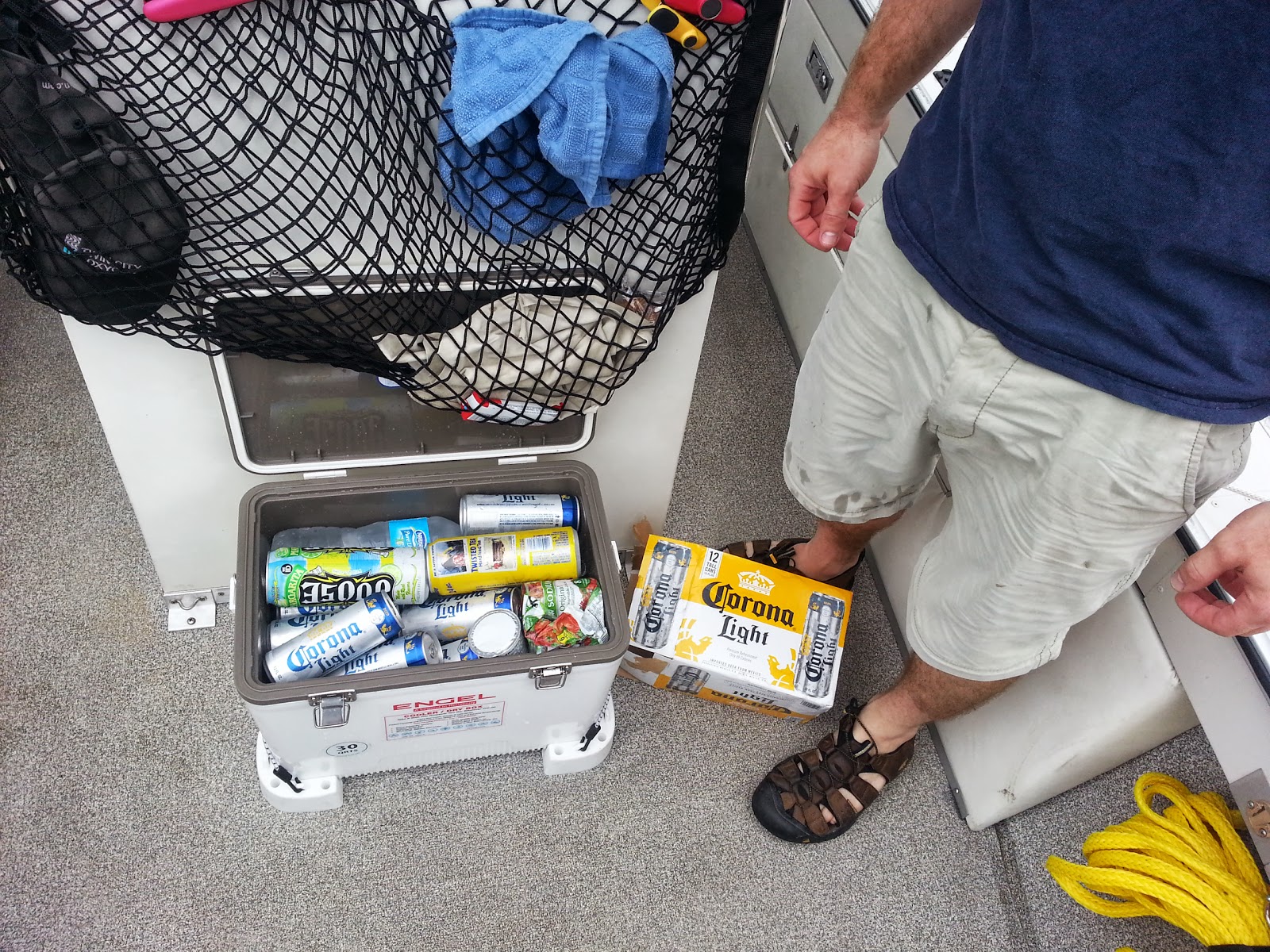 |
| Everything needed for the trip to Destin and then some. Nobody goes thirsty on the Blue Fin. |
 |
| Doesn't this scene shout with irony? Luxury abounds but the port-a-potty still stands front and center in it's dominant role. Our first stop along the barrier islands. |
 |
| We made a brief rendezvous with Matt and Erin in the Gulf Islands National Seashore near Navarre, FL We came by car and they arrived in the boat. |
 |
| This is my first boat traffic jamb. We decided to find a place to eat in Destin Harbor which I'd described as a tourist concentration camp. Boats, people, restaurants, fishing charters, motels, marinas, shops, no parking, hot, sticky, smelly... Are you getting the idea? It's an interesting place but I wouldn't make it my only reason to travel all the way from Minnesota. |
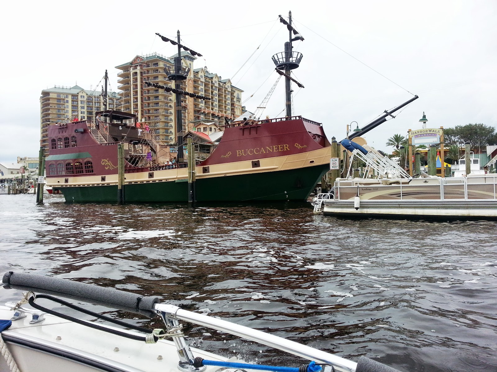 |
| Destin has their own pirate ship. I wonder if they ever do battle with the pirate ship I saw at Orange Beach. |
 |
| A party zone in the sandy shallows. You can step out of your boat into 2-3 feet of water. Vendors setup pontoons as small businesses catering to the partiers. |
 |
| The shoreline inside Destin Harbor is continuously lined with all variety of distraction. Having arrived here by car and leaving by boat I'd say it's easier to find places from the water side than from the street side. |
 |
| The Blue Fin is tied up on the right, we're nearby at an outdoor table at AJ's restaurant, and this kid is doing stunts for the passersby. It was all too much and having seen this I know we've gone far enough on this adventure and it's about time for Mary and me to come home. |
 |
| The Blue Fin arriving at the ramp in Pensacola. The end of its short foray with saltwater and tomorrow it begins the long road journey home. |

 |
| Mary working hard to put things in order for the long road trip back to Minnesota. Notice the closeness of the trailer fenders to the boat bottom. Tomorrow we'll need to do some work on this to keep them from contacting the boat's bottom. Matt had changed the rollers around on the trailer in order to lower the boat and better nest it down between the two fenders. Looks like the fenders themselves will have to be lowered too and we plan to replace them with more commonly available rounded fender skirts. That will have to wait though until we're home and for tomorrow we might just hammer these old ones down to get them out of the way. |
 |
| To put a nice bookend on our journey it seemed fitting to pose with the captains hats we were presented with at the beginning. They survived the trip without getting the least bit dirty or soiled. We didn't use them even once to pull rank on anyone we saw and I'd gauge that the folks we met along the way were at minimum 99% friendly. |
Friday, July 26, 2013
Day 23 - Gulf Shores, AL to Pensacola Beach, FL
Matt and Erin arrived this morning with the Blue Fin's trailer to begin the end phase of our journey. They left Minnesota two days ago and stayed one night with Mary's aunt in Louisville and stayed another night sleeping in the car. I offered to cover them for a motel but they insisted the back of the car, with the back seats folded flat, was very comfortable.
Earlier in the day when the winds were still calm we decided to take the Blue Fin through a pass and out into the gulf. We made our passage through Perdido, where we were yesterday, and the conditions today looked much better. The area was still busy with a good deal of boat traffic that churned up the water but once we pushed through the narrow channel of the pass, and got into the open waters, things smoothed out nicely. The surface had longer swells with a few sharp waves but was generally comfortable and far less troublesome than some conditions we've already seen on our trip. We cruised out to maybe a mile and a half and sat for awhile to take some pics.
We crossed the boarder into Florida at around 1:30 PM just after we finished up having lunch with Matt and Erin. The point where we crossed was out in the middle of the Intercoastal's channel and there was nothing to indicate we had in fact moved on to another state. We did run into a sign a short distance later as we passed through a narrow channel where I suppose it was more practical to post a welcome sign on the nearby shore.
Tomorrow we'll cruise around the area and check out things further to the east as if we were continuing our journey. This time though we'll return back to our starting point in Pensacola Beach to stay another night. The primary reason for this is that it's impossible to find a place to stay on the weekend without an advance reservation and the Hampton Inn where we're staying is sufficiently nice to demotivate us to move on.
 |
| Matt did some reconstruction of the trailer and this means when we pull the Blue Fin out of the water we might need tools to make some adjustments for a proper boat-trailer fit. It was convenient for him to make the trailer repairs while we were using the boat. |
 |
| It was good to have someone else around to take some pictures. An action shot of us making our way from the motel back to Homeport Marina. This will be the last time we use the folding bikes with the Burley trailer on this trip. The peddling is not too hard in these coastal areas as the terrain is very flat. |
 |
| Cruising out into the open gulf. See the happy face on Ms Erin excited to be heading out into the open water. |
 |
| In the Gulf of Mexico looking west at Orange Beach. |
 |
| The view behind us as we came about and headed back toward the shoreline. We could see a marker buoy and some fishing boats a few more miles out. |
 |
| We're being welcomed to Florida. |
 |
| I noticed the wake behind the Blue Fin is more frothy than when it's in fresh water. I did some homework and discovered the cause. This is sea foam and here's your science lesson for the day. Sea Foam |
 |
| The Intercoastal Waterway in this area breaks open into a number of good size "lakes" and with the wind being up this afternoon the sailboats were out. Were following a few through this narrow channel where directly beyond is Pensacola Bay. |
 |
| Our destination for the next two days is directly ahead. Pensacola Beach is a nice size cluster of ocean side resorts along with the associated tourist businesses necessary to have a nice stay. |
 |
| Matt's helping me tie off the Blue Fin at the Pensacola Beach Marina. It's great to have help especially with the slips around here being so huge. We tie off using four lines, one on each corner, to suspend the boat in the middle of the slip. You have to remember to get out of the boat before you secure the last line or you'll need really long legs to step across and up onto the dock's walkway. One other important thing for a Minnesota guy to remember is to leave some slack in the lines because the tide will cycle by maybe one foot before I get back here tomorrow. |
 |
| The ladies watching the fishing guides clean today's catch. Pensacola Beach Marina is home to half a dozen fishing charter companies and is busy this afternoon as they return from out in the gulf. |
 |
| And yet another balcony view as Mary is treated to the high-star motel I had promised her. |
Thursday, July 25, 2013
Day 22 - Mobile to Gulf Shores, AL
A little description of Mobile Bay might be in order so you understand what we faced. Picture the bay as a big upside down U. We were about midway down the left hand side and we needed to get to all the way down to the bottom of the right hand side. The upside down U is about 15 miles wide and 25 miles long and I had decided to run pretty much straight across and then hug the east shore to the bottom where we'll find the entrance to the Intercoastal waterway. The wind was blowing out of the northwest at about 12 mph and increasing so it had the full sweep of the bay from the top left to the bottom right. I didn't like this but if there was anything positive it was that the wind would tend to push us toward our destination and once I got across it would be more at our rear which, if you could choose, would be the best choice. The estimated time to get across was about one and a half hours to the inlet.
 |
| Grand Mariner Marina in the Dog River near Mobile. We pushed off from here this morning at 7:45 AM and nobody was around to see us off. It's not foggy. The camera lens had condensation on it from the high humidity. |
 |
Outside the Dog River and looking east across Mobile Bay. I could see a barge, a marker platform and a sliver of land on the other side. The water gradually became rougher the further we advanced toward the other side until we were about one mile offshore when it calmed slightly. The biggest waves were about 2/3 of the way across and they were aggravatingly irregular in that I could run OK for say a 15 seconds and then I'd be in a patch of nasty criss-crossing waves and on a good number of occasions the Blue Fin plunged deep into a coming wave and the water surged up and away from the bow spraying us with the brackish salt water. Fortunately the irregular shape of the eastern shoreline made an obstacle to the wind and slightly broke the waves improving the surface conditions greatly. We rode the eastern shoreline down to the inlet and made it across successfully and into the Intercoastal.
|
 |
| Riding the eastern shoreline and in much calmer waters. The inlet we're looking for is still 15 miles south of our position. Mobile bay is a shallow body of water and in this picture the water was about 2-3 feet deep. It remained that way for most of the run down the eastern shoreline. I didn't observe anyplace in the bay where we had traveled where the depth was greater than 14 feet. It might however be slightly deeper than what I was reading on the LCD chart because I still hadn't set the calibration for saltwater rather than freshwater. The speed of sound in saltwater is slightly faster than freshwater resulting in less transit time for the sound impulse to hit the bottom and return. This would cause the depth readings being displayed to be lower than actual. |
 |
| And finally at 9:30 we had a visual on the entry to the intercoastal waterway making the crossing closer to two hours rather than the 1.5 hours that I had thought. If you are unfamiliar with the Intercoastal Waterway, it's a narrow channel of water that is maintained in coastal areas to create a passage protected from the open seas for commercial and small watercraft. People in coastal areas know it for what it is in the same manner that people in the Midwest know the Mississippi for what it is, a place where they can go boating. |
 |
| The first establishment that we came upon on the Intercoastal. We needed a break and Lulu's would do. We docked and went in but only the gift shop was open. The restaurant would be another hour. We begged for some coffee and a nice lady who earned a $3 tip got us two big cups full and we sat in the outdoor seating area and made our plans for the rest of the day. |
 |
| Chilling out after crossing Mobile Bay. |
 |
| Mary said she's sure she prayed the whole rosary during the bay crossing. Now she's just happy to hang out and be cool at Lulu's. |
 |
| Take a peek at this. The Blue Fin meets one of its relatives, a porpoise fin! |
 |
| Tied up for a lunch break at the Cobalt Restaurant. A nice place with a nice price. Our lunch was free thanks to work buddy Todd who sometimes stops here when he visits his parents who retired nearby. He had prearranged to pay via phone before we even arrived. |
 |
| Look at this cheesy tour boat. Up close it looks like it's made of plastic and do they really think the tourist can be convinced they're pirates. It floats around getting in the way of other boaters, shooting off a fake cannon, and generally being obnoxious. I'm glad I don't have to ride on it. |
 |
| Holding the Blue Fin in shallow water. Those folks near the boats behind me are standing on the bottom too. The bridge in the background spans the Perdido pass that goes out into the gulf. I cruised out that way but Mary made me turn back. I figured it couldn't be any worse than Mobile Bay was this morning. |
 |
| Tied up at the Homeport Marina for the night. While at the beach today I gave the Blue Fin a good wash down so it looks presentable in it's more affluent surroundings. That polyurethane paint job we gave it is really tough. There are hardly and chips in 1700 miles and the scum just wipes off without any remaining stains. Two little kids were standing around pointing at the boats and dreaming about the one they'd like to someday own. I asked them which boat they thought was mine. They couldn't believe I had the smallest boat in the whole marina. |
Wednesday, July 24, 2013
Day 20 - Demopolis to Bobbys Fish Camp (part 2)
Now that I'm back in civilization I'll add a few more pics covering our journey for Day 20.
 |
| The Demopolis Yacht Basin. A pretty mice marina with lots of big boats hidden away in another harbor. I heard these boats come up from the gulf during hurricane season to get a break on their insurance rates. The Blue Fin is sitting down there in the cheap section. |
 |
Hey, look here! A picture of a barge tow that I promised I wouldn't take. This big boy was being repaired at the gas dock where I fueled up the Blue Fin. The clutch went out on the left engine and it was stuck in gear. The cap said they handle real bad when that happens. I asked him how long it takes to be trained to handle one of these and it's about 4 years. You must start working at the lowest level and work your way up through ranks so when you're the cap you've experienced every job. Pay at the top level is well into 6 figures but the schedule isn't for everyone with 20 days on and 10 days off as typical.
|
 |
| This is the dash board of the courtesy car at Demopolis Yacht Basin. The courtesy car is available for use by anyone paying to stay at the marina and it can be had on a first come basis. This poor car was so neglected that the only lights on the dash were warning lights. I felt sorry for it and thought of that TV commercial where they try to get you to donate to help unloved and abused dogs. Mary and I used it to go to Walmart to buy eight bottles of HEET to add to the water laden gas in the Blue Fin. We made it OK and it was fun to drive again as it was 20 days since I was behind the wheel. |
 |
| This is just downstream of the lock and dam at Demopolis with the morning fog lifting. After we got underway we immediately came upon this dam and were delighted to see the lock gate opened and waiting. I didn't tell Mary this dam is a complete spill-over dam and from upstream you see nothing but smooth water and the horizon beyond. The only clue that the river ends is a sign and a few buoys that if approached closely enough to read would be too late. |
 |
| As the morning wore on the skies cleared up and the temps went up quickly to near 90 degrees. The forecast was for afternoon thunderstorms but you'd never know it from this pic. |
 |
We came upon these two kayaker dudes paddling along at a nice clip. I slowed and asked them where they're going and where they came from. Virginia is where they started and the Gulf is their goal. They didn't take the water or pop we offered them and said they planned to get 25 miles further downstream today. They should be them in the gulf by this coming weekend.
|
 |
| The ride was long and this is the first time in our travels where Mary was driving and I almost nodded off. After 5 hours of constant motion we arrived at the welcome sight of Bobbys Fish Camp. This is the only fuel stop that sits smack dab in the middle of the 220 mile stretch from Demopolis to Mobile. Nobody passes here without stopping to put on fuel. I'm sure there are many times when the value of the boats at the dock exceed by a considerable amount the value of the entire place. |
 |
| The welcome sign at Bobbys as you come off the dock. Our little cottage was the one on the left. I believe they might have the longest gas hose in the world. The attendant up the hill at the office resets the pump and you operate the nozzle down on the dock about 500 feet away. I didn't realize this and just grabbed the nozzle and pumped away. After filling the 6 gallon tank the fuel sputtered out and it became apparent the pump up above was not even on and I had just drained the line. My first thought was "free gas" but since I still needed to fill the main tank I in fact had to pay to re-fill the long gas line I had just emptied. To be fair to Bobbys the gas line to the docks is an industrial grade buried line that has good integrity but the flow dynamics are as I stated. |
 |
| Inside the store/restaurant at Bobbys Fish Camp. |
 |
| The nice blue skies a few pics up turned to this in a couple of hours. The Blue Fin tied up at the dock right behind the trees. |
Day 21 - Bobbys Fish Camp to Mobile, AL
We left Bobbys at 7:15 AM and just like yesterday, we had the dam at Coffeeville a few miles downstream to lock-through. Our luck was good again since a boat had been there already waiting and got the locks qued up in time for us to cruise right in behind them. In 20 minutes we were through and on our way to ticking off the 120 miles to Mobile. We faced the most remote stretch in our journey today but our confidence has improved since we figured out the motor problem and had a problem free day with it yesterday.
 |
| The river wasn't completely without human presence. This place looks like a fisherman camp and we saw at least a dozen boats along the way with folks fishing. They have to appreciate having an almost private river for their solitude. |
 |
| This fellow on his 4 wheeler kept right up with us as we cruised along this nearly mile long beach. |
 |
| Look closely and you'll see a palm near the waterline in the left half of this pic. About 40 miles to Mobile and nice to see something tropical but disappointingly no gators have been spotted. |
 |
| Approaching Mobile and we're now in tidal waters. The Blue Fin is soon to be introduced to saltwater. |
 |
| Cruising through the industrial canal near downtown Mobile |
 |
| Here's where I can get some of those cargo containers to build a house like I saw a few days ago. |
 |
The Grand Mariner Marina at the Dog River inlet in Mobile, AL We but the Blue Fin up here for the night and hitched a ride to the Holiday Inn about 4 miles away.
|
 |
| The fellow in the red shorts is named Troy and he offered to take us to the Holiday Inn. We first had to wait for him to unload the crab traps he had hidden all around the marina. The cooler was nearly half full by the time he emptied his 7 traps. On the way to the motel he toured us around his neighborhood to show us how things have been rebuilt since hurricane Katrina in 2006. His house sustained $62,000 in damage from flooding and the interior was gutted out to rebuild it. |
Tomorrow the motel shuttle will return us to the marina and we hope to once again get an early start. Today when we entered Mobile Bay we ran into 20 MPH winds and small craft advisories were out. To minimize our exposure we kept to the west shoreline and slipped into Dog River where there are many choices for marinas. We had originally planned to cross the bay to the east side and hang out at Fairhope but it was too rough and I didn't know the best route to get there. The plan tomorrow is to beat the wind by starting early to get across the bay to the Intercoastal with its protected waters. The trip across will entail a 25 mile trip if we stay in the marked channels. I'll ask some of the old guys at the marina tomorrow about the possibility of a shortcut and my reliance on the Humminbird LCD charts will be greater than ever. It will be a fun challenge to navigate in a body of water where the destination cannot be seen and the use of a chart is necessary to at least minimize hunting around to find your way.
We have no specific destination tomorrow except to gradually work our way east. Stopping somewhere around Orange City is a good possibility and we'll begin to look for a place tomorrow after lunch. With the weekend coming we'll probably do a little advanced planing to assure we have a place to stay then.
I heard from Matt and he's made it to Louisville where he'll have a night over at Mary's aunt. Then he'll continue to head this way tomorrow with the Blue Fin's trailer. I expect to see him tomorrow night or Friday morning with his girlfriend Erin and they'll tour around with us until Sunday when we'll head home. At this time we believe we'll get to Fort Walton Beach or thereabouts before we end this adventure.
Subscribe to:
Posts (Atom)