Excellent is the best way to describe the weather we're experiencing. We were greeted to a superbly scenic sunrise from our motel room in Louisiana this morning but as with all things, the feeling doesn't last and we felt the pressure to get on our way. As I mentioned yesterday, we wanted to up our daily average of miles covered so by 8:30 we were on our way out of the Two Rivers Marina and headed downstream.
 |
| Sunrise over the Mississippi River bridge in Louisiana, MO. Well almost sunrise. I was never known to be an early riser and you can tell by the Sun's position it's closer to 8:00 AM than 6:00 AM. |
As we started out the air was cool and was able to chill us to the point where we needed some covering. It didn't take much and by simply putting on our life jackets we trapped enough body heat to feel warm. The lensing effect that I had mentioned earlier was with us almost until noon and was a good helper in spotting buoys and floating debris. It was almost like a magnifying glass held by mother nature ever so slightly above the horizon, allowing me to spot buoys and debris at a great distance. The buoys looked to be at least twice their normal size when first spotting them on the horizon.
Speaking of buoys, I've come to a realization that something dangerous is lurking under the water and I've seen it at least 4 times now. The underwater monster is sunken buoys. I'd estimate that maybe one in 10 buoys is misplaced and 1 in 20 is just missing. This is from the 3 separate flood cycles that have occurred thus far this year on this part of the river. I don't know what exactly a flood does to the buoys but I do now that some of them were just carried off by huge floating trees. I've seen them sitting almost 1/4 mile from their proper location entangled with branches, and tree trunks, and even whole trees. So why am I concerned? Well here's the scenario that causes my worries. I use the Navionics chart display that is very accurate at displaying the buoy locations and as I said earlier it is probably at most a few hundred feet diffeent from the actual buoy location. Now while I'm piloting the boat, I usually try to cut the best line ahead of me meaning that I want to minimize wandering back and forth across the river. This would be similar to what a slalom snow skier does to get down the hill in the shortest and fastest possible route. I simply hug the buoy whenever it makes sense to improve my trajectory and I will do this even if the buoy was not seen by me because I rely on my Navionics chart when it says it should be there. This all changed after I spotted a fairly good patch of turbulence near the location where the Navionics was clearly showing a buoy but I could not visually spot it from a distance. The turbulence was caused by the buoy, which wasn't too far from where it should properly be, but is was just slightly under the surface making a real ruckus in the 4 mph current. If I were to hit one of these it would be the end of everything. The motor would be destroyed and the boat could well have a hole torn in the hull. We'd be going down. You have to realize that these buoys are about 10 feet long and 3 feet in diameter made of tough steel. The 1/16 inch aluminum of the Blue Fin's hull is like tissue paper in comparison. From this time on I'm going to steer a line down the center of the channel whenever a buoy is not visibly evident and the the Navionics is saying it should be. In the center of the channel the big barge tows do the job of keeping things cleared up for us little guys so the center is the safe place to be.
Let's do a quick photo rundown of the day:
 |
| Two weeks ago I was worried about some closed lock and dams in the Southern Iowa and Northern Missouri area. I had been curious to understand what actually happens to cause a lock to be closed. Here's the answer. See the sand bags stacked on top of the lock chamber wall. The water gets high enough to get into the equipment that controls the lock gates and valves. |


 |
| The three photos above are of Clarksville, MO. This is a nifty little town that treats tourist real well. They are having a tough year of it so I think you should go there and spend some money. We did and had the whole town to ourselves. |

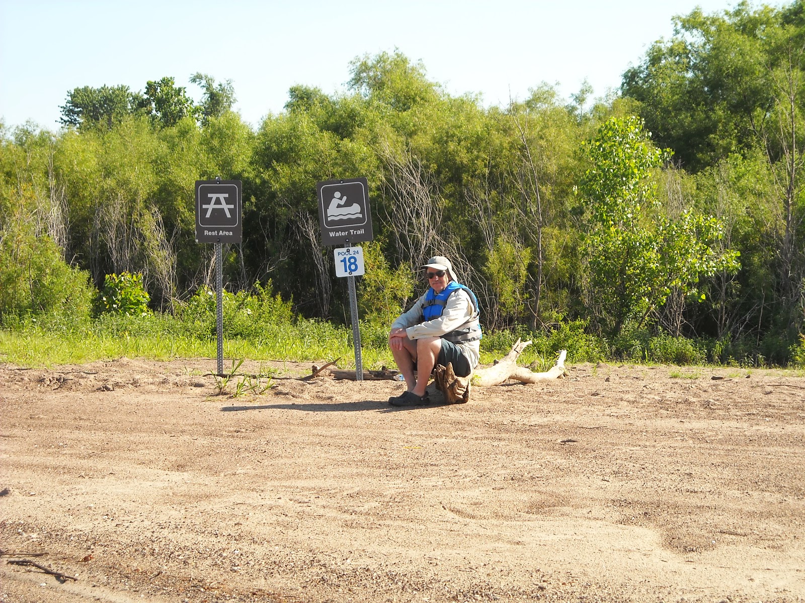 |
| Mary sits in the boat while I sit on a log. Waiting for another barge to get through the locks at dam #24. If we can find a spot to beach the boat while waiting for a lock-through we usually do. When my turn comes up I need to either be within visual range of the lock gates to see their green light or arrange to have the lock master call me on the radio which they'll happily do. But I better not get to far away because once they're ready you'd better be at the gate and and poised to enter within a few minutes. There has been more than one time when I had the Blue Fin pegged at full speed (33 mph) to get to the gate in time. |
 |
| Wandering around on an island. A distant shot of me returning from a necessary stop. |
 |
| Our Lady of the Rivers. The Mississippi and Missouri Rivers are being watched over. Still about 15 miles upstream of the Missouri. |
 |
| Cliffs just south of Grafton, IL. |
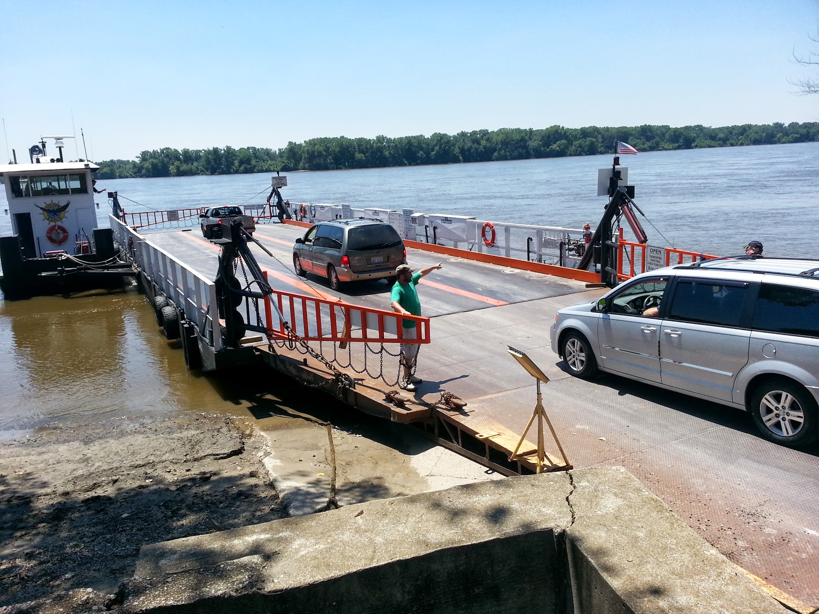 |
| A ferry loading cars to cross the Mississippi. I explained to Mary that we had once before been here and rode our Honda scooter onto this ferry. She said she remembered a ferry but had no idea where it was. |
 |
| The Blue Fin all tucked in for the night at the Alton Marina. Note the semi-famous William Clark bridge in the background. |

 |
| In case you think this is a low budget vacation here's proof this is a top drawer affair. Nothing makes the ladies smile more than fancy surroundings. Our overnight accommodations at the Beall B+B in Alton. |